Geographic “closing” (Part One)
Do not think that in the only opening occurring during the study of the earth mysteries. Quite often it happens, and geographic “closing”, that too is a kind of achievement in science.
Let’s look at a map. Until recently, with the image maps of the Atlantic Ocean floor, in an area between Greenland and Svalbard archipelago, oceanographers, researchers noted a large ridge, called the Threshold Nansen. Now it’s location on the map is corrected, because the mission of the former Soviet Union, to take a trip on the ship “Lena” at the bottom of the studies in this area have not discovered the ridge. In fairness, it should be said that, in some places, sounders signaled to scientists on individual seamounts quite significant, but between them discovered and wide kind of “straits” with recesses 3000 M. Consequently, the mythical underwater Threshold Nansen, whose existence many years geographers have been assured, “closed” for the last time.
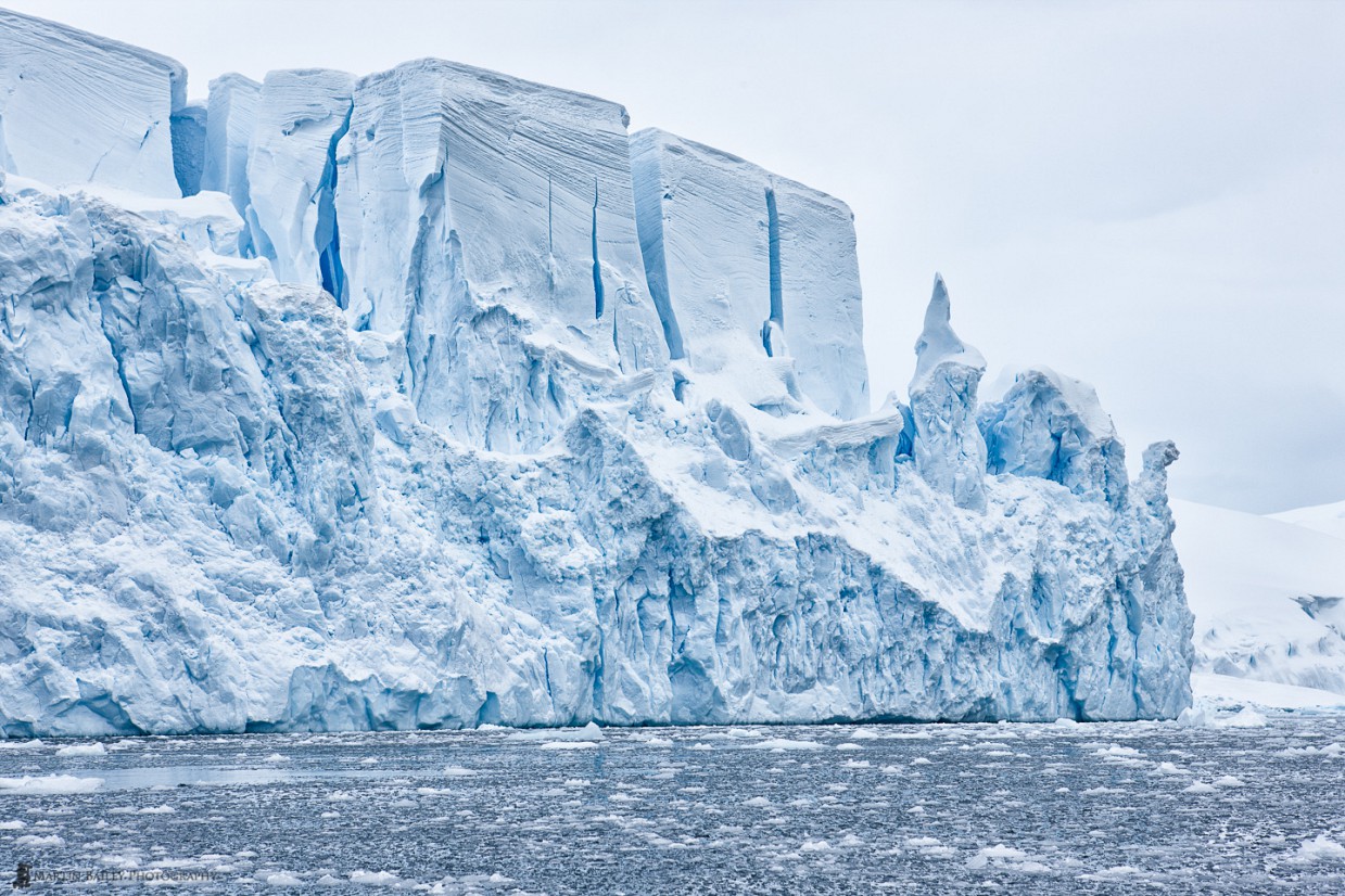
But, probably, the greatest number of geographic “closing” of the famous coast of Antarctica. Periodically on this continent come off giant icebergs – floating islands, almost the same as our Arctic, but much larger. Some of these floating reservoirs contain much more water than, for example, the annual runoff of the Dnieper or Volga!
It has been estimated that the icy shores of Antarctica gradually shifted to the north at a speed of from 50 to 500, and at times up to 2000 m per year. Because of this shift, it is constantly changing and the coastline of Antarctica.
So, for example, on a huge breakaway iceberg recently sailed in the ocean expanses Cape Amery, bays Evans Torehavn and Ingram. Gone is the Prydz Bay and Mackenzie.
In their place appeared a large bay. As a result, if the world-famous Norwegian explorer R. Amundsen today again landed on the coast of Antarctica, he would simply have not found the famous Whale bay, which housed the base of his expedition Fram-Hein, with whom he traveled to the South Pole He, became the first person to reach it. As it turned out, this part of the coast along with a huge iceberg sailed north as far back as 1940. In early 1963 what remained of a floating island encountered on the path of one of the American ships navigating in the Ross Sea, and the remains at a distance five hundred kilometers from the coast.
In the same way big enough Chelyuskintsev peninsula that was opened by members of the Soviet Antarctic Expedition in 1956, it is constantly changing, finally broke away from the mainland in 1964 and became an island area of 5000 square meters. Km, which is swaying like a ship, swam slowly, driven over, the north, in order to melt away without a trace in the hot waters of the tropical region of the Indian Ocean.
Also in 1959, Russian scientists were “closed” island Swains Island and Macys Island laurels pioneers that even with 1800. It belongs to the English captain Swains. Located at 59 m. South latitude and 90 c. west longitude, these islands as it turned out later, were icebergs. At the time, it was necessary to “close” even depicted on all American and Norwegian maps Volcano Sovold. Is this 300-meter-long giant on the mainland nearby Ice Shelf?
And in 1982, members of the world expedition, follow in the footsteps of the first Russian expedition under the control of FF Bellingshausen and Mikhail Lazarev, it was found that the island Terra Nova – just a big floe, which will one day split off from continent and set sail, as in his time, Clary went to Earth, open the French traveler Pont d’Urville.
In addition, there is evidence of a new iceberg with impressive dimensions of 134 by 37 km in 1987, which is separated from the mainland, has caused significant changes in the coastline area of the Ross Sea. Because of counting the amount of water contained in this colossus, it appeared that it would be enough to ensure that in the course of 2100 (!) Years to supply water such as a city Kiev.
But most of the huge iceberg was registered in 1951, he caught the eye of scientists in the South Pacific, and its dimensions are just huge – 97 to 335 km. The area of this iceberg was a little smaller than the area of Moldova, Armenia, but much more space. According to many scientists, the growth of separating from the mainland giant icebergs is a testament to what is happening on the planet warming.